

- What Is a Geospatial Data Management Systems (GDMS)?
- Why GDMS is Crucial in Today's Business Environment
- Key Features and Benefits of an Effective GDMS
- Case Studies of Successful GDMS Implementations
- How to Choose the Right GDMS for Your Organization
- Tips for Effective Geospatial Data Management
- Future Trends in GDMS and Geospatial Technology
Geospatial Data Management Systems: Common Mistakes to Avoid
Geospatial data is the backbone of critical decision-making across industries, from urban planning to logistics to environmental conservation. But managing, analyzing, and leveraging this data effectively can be a challenge, given its sheer complexity and volume. This is where Geospatial Data Management Systems (GDMS) come into play, revolutionizing the way professionals store, process, and interpret location-based data.
Whether you’re a GIS professional, a data analyst, or an IT manager, understanding the importance and potential of GDMS can give your organization a competitive edge. This guide will cover everything from the fundamentals of GDMS to its business value, key features, and future trends, so you can get the most value out of geospatial data.
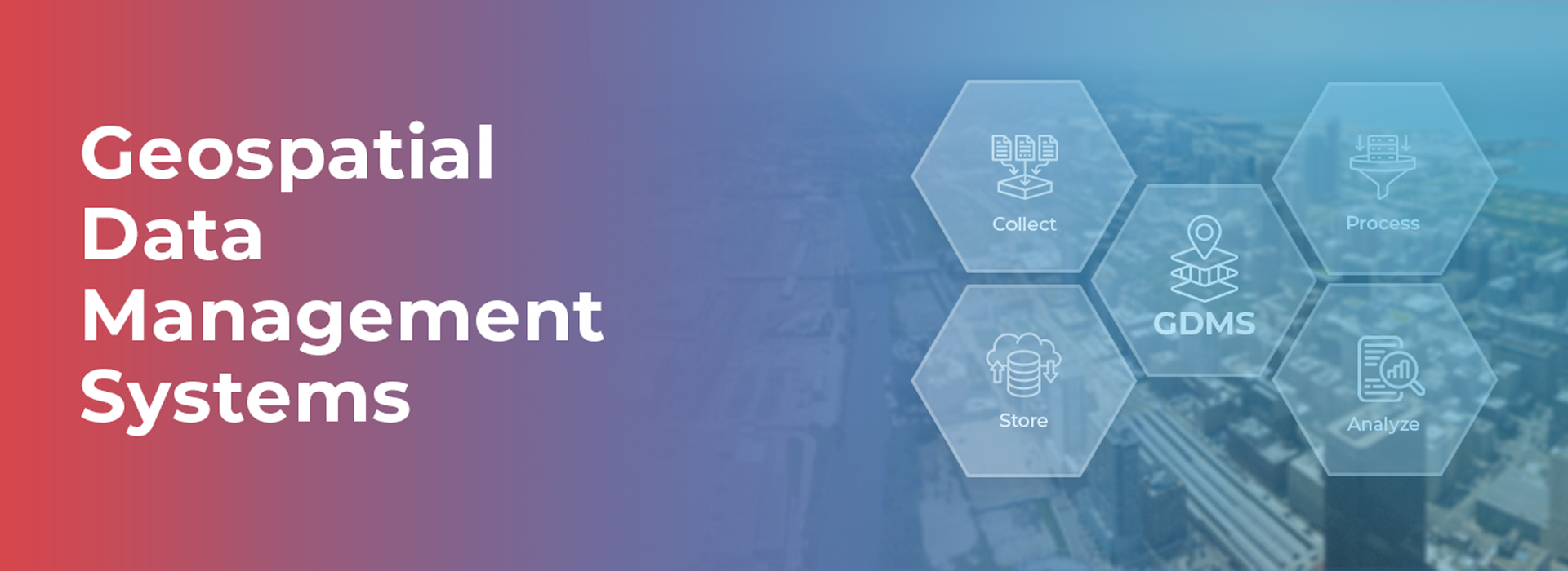
What Is a Geospatial Data Management Systems (GDMS)?
At its core, a Geospatial Data Management Systems (GDMS) is a comprehensive platform designed to collect, store, process, and analyze geospatial data efficiently. This data includes anything with a geographic or spatial component, such as maps, satellite imagery, sensor data, GPS coordinates, and even social media check-ins.
Instead of employing traditional data management solutions, GDMS has been created to work with the hurdles posed by spatial data—its size, complexity, and the necessity for real-time analysis—and syncs effortlessly with GIS technologies.
Forward-looking organizations are reinventing their operations using GDMS’ advanced tools that allow turning raw geospatial data into actionable insights. These systems are at the forefront of creating smart cities, optimizing supply chains, and even addressing climate change.
Why GDMS is Crucial in Today’s Business Environment
A GDMS is indispensable for a business since the exponential growth of spatial data turns geospatial tools from an optional add-on into necessary components. Addressing its importance are some rationale which justify its importance:
- Smarter Decision-Making: GDMS allows companies to track and monitor shifts in business that can be applied for specific geofenced regions.
- Operational Efficiency: To improve business operations, GDMS can improve efficiencies through automating workflows or reducing redundancy while improving data accuracy.
- Improved Collaboration: Keeping data and geospatial analysis within one central location allows all team members from varying departments to access the latest geospatial information with ease.
- Industry Applications: Agriculture, real estate, city planning, and other industries can improve their resource management with GDMS.
With companies like Macgence—a leader in providing data for training AI and ML models—leveraging GDMS becomes even more critical for refining predictive analytics and machine learning algorithms.
Key Features and Benefits of an Effective GDMS
A high-quality GDMS is defined by its robust capabilities. Here are some must-have features:
1. Scalability
- Handle vast amounts of geospatial data without compromising performance.
- Ensure flexibility to grow alongside your data needs.
2. Real-Time Data Processing
- Enable real-time analytics for dynamic decision-making.
- Improve response times in time-sensitive industries like transportation and disaster management.
3. Integration with GIS Tools
- Seamlessly integrate with leading GIS platforms to enhance geospatial analysis.
- Support compatibility with formats like shapefiles, GeoJSON, and KML.
4. Data Visualization
- Create intuitive maps and dashboards for better communication of insights.
- Make data more accessible to non-technical team members.
5. Data Security
- Protect sensitive geospatial information with advanced encryption and access controls.
6. Artificial Intelligence (AI) & Machine Learning (ML) Compatibility
- Harness AI/ML capabilities to train models with location-based data. Macgence, for example, utilizes GDMS to deliver high-quality data for AI training.
Benefits include:
- Enhanced data accuracy and reliability
- Faster project timelines
- Reduced operational costs
- Better foresight into trends and anomalies
Case Studies of Successful GDMS Implementations
Here’s how GDMS has transformed organizations across industries:
1. Urban Planning
Using GDMS, a metropolitan area was able to identify traffic flows and adjust public transportation routes which subsequently lowered congestion levels by 25% in two years.
2. Agriculture
Because of GDMS, farmers were able to monitor and evaluate soil quality in relation to the weather patterns which in turn resulted in a 15% increase in crop output.
3. E-Commerce and Logistics
This improvement enabled online retailers to further improve customer satisfaction through GDMS by optimizing warehouse locations, and as a result reduced average delivery time by 20%.
These examples illustrate the versatility of GDMS in addressing diverse challenges and driving success.
How to Choose the Right GDMS for Your Organization
When choosing a GDMS, consider the following steps to find the perfect fit:
- Assess Your Needs: Identify your organization’s specific geospatial challenges and data requirements.
- Scalability & Customization: Ensure the system can adapt to your organization’s growth and allow custom integrations.
- Vendor Credibility: Look for providers like Macgence with proven expertise in geospatial and AI-related solutions.
- Ease of Use: Prioritize intuitive interfaces and tools for your team’s productivity.
- Customer Support: Choose a system with reliable technical support to troubleshoot issues seamlessly.
Remember, the right GDMS can revolutionize how you work with data, giving you insights that weren’t previously visible.
Tips for Effective Geospatial Data Management
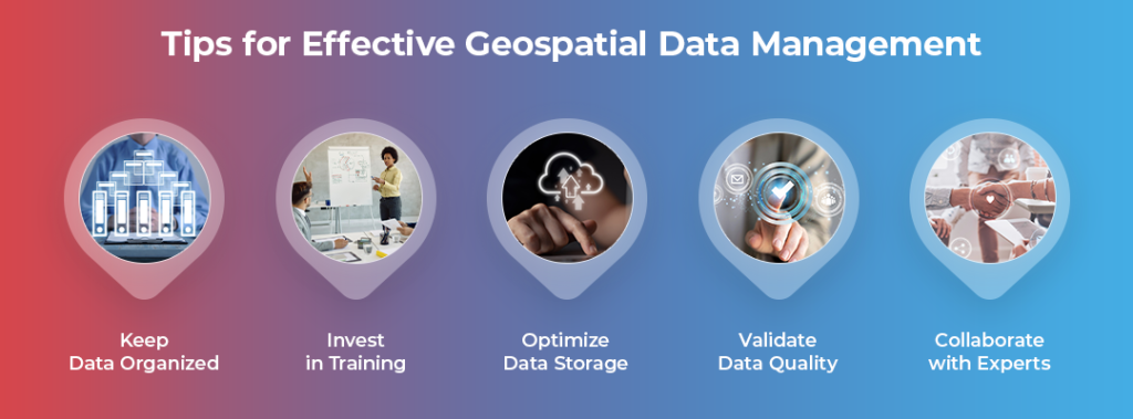
- Keep Data Organized: Regularly update your datasets and assign consistent naming conventions.
- Invest in Training: Equip your team with the skills needed to maximize GDMS capabilities.
- Optimize Data Storage: Use cloud-based solutions for scalability and reliability.
- Validate Data Quality: Ensure consistency and accuracy with periodic data audits.
- Collaborate with Experts: Work with companies like Macgence to leverage their AI-ready datasets and ensure best practices.
These tips can help you maintain efficient, accurate, and actionable geospatial data workflows.
Future Trends in GDMS and Geospatial Technology
The world of geospatial technology is advancing rapidly. Here are some forward-looking trends:
- AI Integration: Tools are becoming increasingly adept at predictive analytics, allowing better risk management and scenario planning.
- IoT & Edge Computing: Devices like smart sensors will feed real-time geospatial data into GDMS systems for hyper-accurate insights.
- 3D Mapping: Immersive 3D visualizations will enhance industries like real estate and urban planning.
- Blockchain for Data Security: Blockchain will bring enhanced security and transparency to geospatial data sharing.
By investing in a high-quality GDMS now, your organization can stay ahead of these trends and be ready for the future.
Empower Your Business with the Right GDMS
The worth of geospatial information can never be forgotten but harnessing its value calls for a solid Geospatial Data Management System. From evaluating customer interaction to customer engagement, GDMS enables businesses to make better decisions and increase productivity.
Looking to maximize your geospatial data’s potential? Partner with Macgence—leading innovators in AI and GIS solutions—and start exploring advanced geospatial data management systems to transform your organization’s workflow.
Take the first step today and explore the best geospatial data management system solutions with Macgence!
FAQs
Ans: – A system of managing geospatial data is a system that allows for the acquisition, archiving and analyzing spatial data along with generating insights for informed decisions.
Ans: – A geospatial data management system enhances decisions, operational effectiveness, and the adoption of information-centered strategies throughout the economy in logistics, farming, and city development.
Ans: – Macgence specializes in providing high-quality geospatial data to train AI/ML models, ensuring accuracy and excellence in your projects.
 Previous Blog


You Might Like

February 28, 2025
Project EKA – Driving the Future of AI in India
Spread the loveArtificial Intelligence (AI) has long been heralded as the driving force behind global technological revolutions. But what happens when AI isn’t tailored to the needs of its diverse users? Project EKA is answering that question in India. This groundbreaking initiative aims to redefine the AI landscape, bridging the gap between India’s cultural, linguistic, […]

March 7, 2025
What is Data Annotation? And How Can It Help Build Better AI?
Spread the loveIntroduction In the world of digitalised artificial intelligence (AI) and machine learning (ML), data is the core base of innovation. However, raw data alone is not sufficient to train accurate AI models. That’s why data annotation comes forward to resolve this. It is a fundamental process that helps machines to understand and interpret […]
March 6, 2025
Vertical AI Agents: Redefining Business Efficiency and Innovation
Spread the loveThe pace of industry activity is being altered by the evolution of AI technology. Its most recent advancement represents yet another level in Vertical AI systems. This is a cross discipline form of AI strategy that aims to improve automation in decision making and task optimization by heuristically solving all encompassing problems within […]

March 5, 2025
Use of Insurance Data Annotation Services for AI/ML Models
Spread the loveThe integration of artificial intelligence (AI) and machine learning (ML) is rapidly transforming the insurance industry. In order to build reliable AI/ML models, however, thorough data annotation is necessary. Insurance data annotation is a key step in enabling automated systems to read complex insurance documents, identify fraud, and optimize claim processing. If you […]